We use the details you submit to review and respond to your project enquiry. Entries are handled in this website’s WordPress database using Fluent Forms; our hosting and email providers may process the submitted details. Other technical providers receive only the data described in our Privacy Policy.
Please do not send passwords, payment-card details, government identification numbers, sensitive personal data, or unnecessary confidential third-party information.
Reviewed by the Storm Manage technical team | (Updated July 2026)
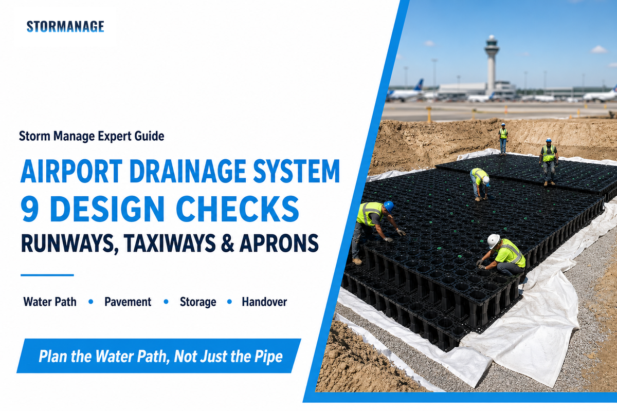
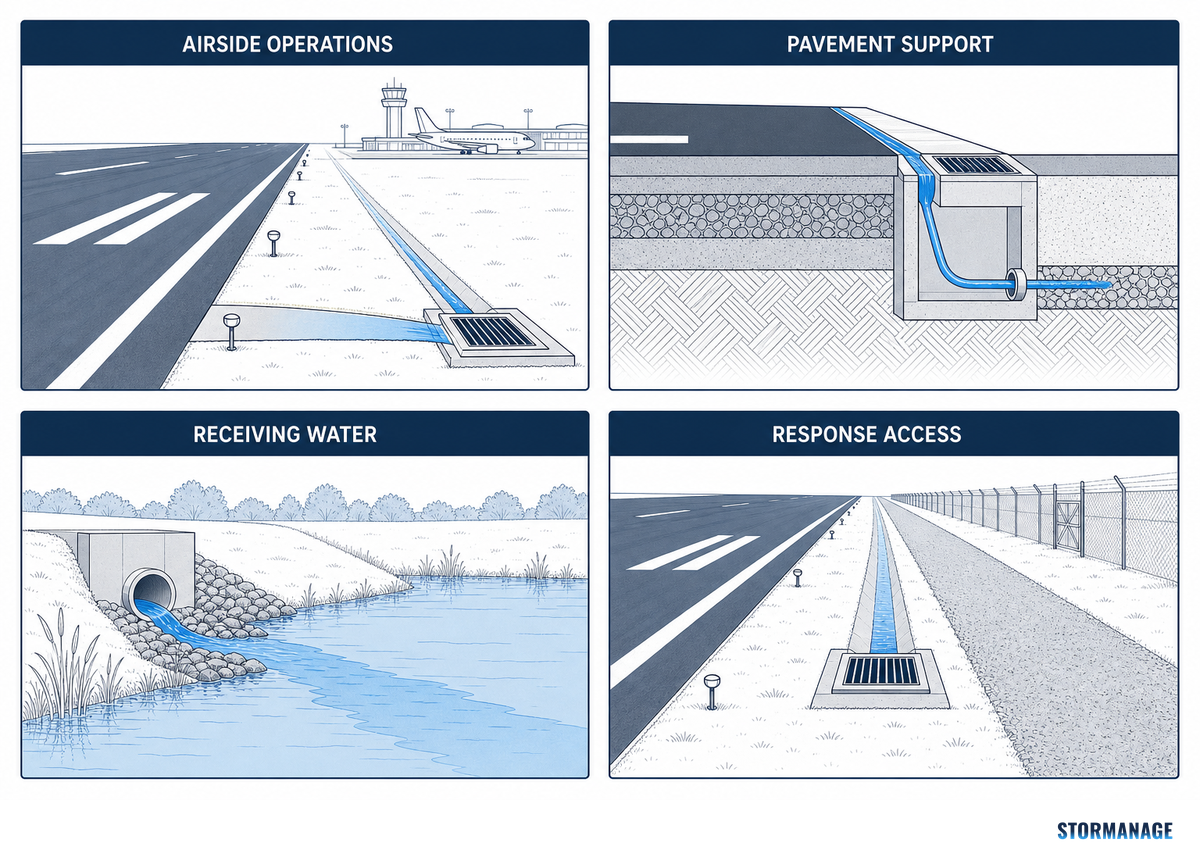
An airport drainage system is a documented water path, not simply a line of inlets and pipes. It protects airside operations, pavement support, receiving waters, and the people responsible for responding when rain, snowmelt, debris, or service-area fluids interrupt that path.
Direct answer: An airport drainage system should trace each water source from grade to a controlled destination, while keeping airside, pavement, water-quality, and approval constraints visible.
TL;DR
Surface and subsurface paths both matter on paved runways, taxiways, and aprons.
No rainfall event is a universal design basis; local hydrology and authority criteria control.
Stormwater, washwater, aircraft-deicing discharges, and pavement-deicing runoff need separate decisions.
More detention volume can create a wildlife-hazard question rather than solve every airside risk.
Quick Specs
Airside zones
Runways, taxiways, aprons, service areas, and their pavement support layers
1. What an Airport Drainage System Must Protect Before It Moves Water
FAA’s live record for Advisory Circular 150/5320-5D, Airport Drainage Design, lists it as active and describes its scope as surface storm drainage plus subsurface drainage for paved runways, taxiways, and aprons. Its scope prevents airport planning from being reduced to one visible grate or one downstream pipe.
Airport drainage is essential, but the design of airport drainage is context-led. A drainage system design for airport environments has to support runway safety, air traffic continuity, and operational safety and efficiency without reducing each outcome to a pipe schedule.
An airport drainage system protects four linked outcomes, not just a surface inlet.
Water-path category
Risk if evidence is missing
Review question
Surface low point
Ponding and foreign-object debris movement
Does the survey show where water actually concentrates?
Pavement support
Persistent moisture can weaken the support condition
Is subsurface water traced separately?
Service area
Wrong water type reaches the wrong control
Is the source water identified before routing it?
Outfall or control
Unclear downstream responsibility
Who accepts flow, quality, and event records?
Surface drainage
Runway flooding or an unverified ponding route
Does the mapped route reach the intended inlet?
Drain systems
A hidden break between assets
Can the entire route be inspected?
Landside areas
Erosion of slopes or disputed discharge
What condition applies beyond the airside boundary?
Inspection access
A known defect cannot be reached safely
Who can inspect during the operating window?
Common mistake: A drainage component isn’t a drainage path. Useful briefs name the source area, low-point evidence, pavement interface, route, destination, and owner of each handoff. That structure supports operational safety without pretending that one generic detail fits every airport.
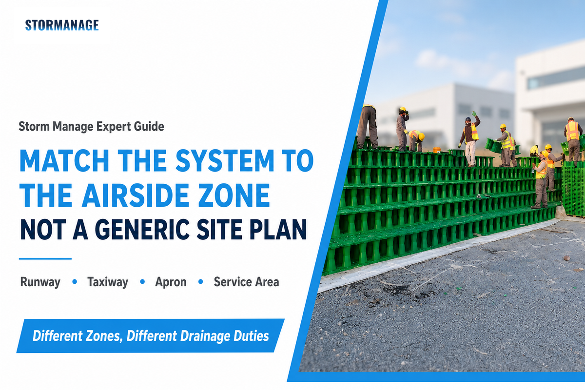
2. Match the Drainage Type to the Airside Zone, Not to a Generic Site Plan
Assign the types of airport drainage system by zone and water path. ACRP stormwater hydrology guidance helps frame movement across and through the airport landscape. Airport drainage design has different questions at a runway edge, beneath pavement, at an apron stand, and at a landside swale. A zone register showing what enters, what must stay out, and who can inspect it is more useful than the phrase “drainage system in airport.”
Sound design of airport drainage systems should connect runways and taxiways, surface drainage, subsurface controls, and downstream management systems. It shouldn’t assume that every zone can use identical drain systems or meet stringent requirements through one standard detail.
Zone
Primary drainage question
Evidence to request
Runway and taxiways
How do grades move surface water away from operating pavement?
Write the requirements of airport drainage system work against this register, with local airport and environmental rules taking precedence over a generic guide. This also prevents a service-area water issue from being treated as ordinary stormwater.
3. Set the Runoff Design Basis Before Sizing Any Drain
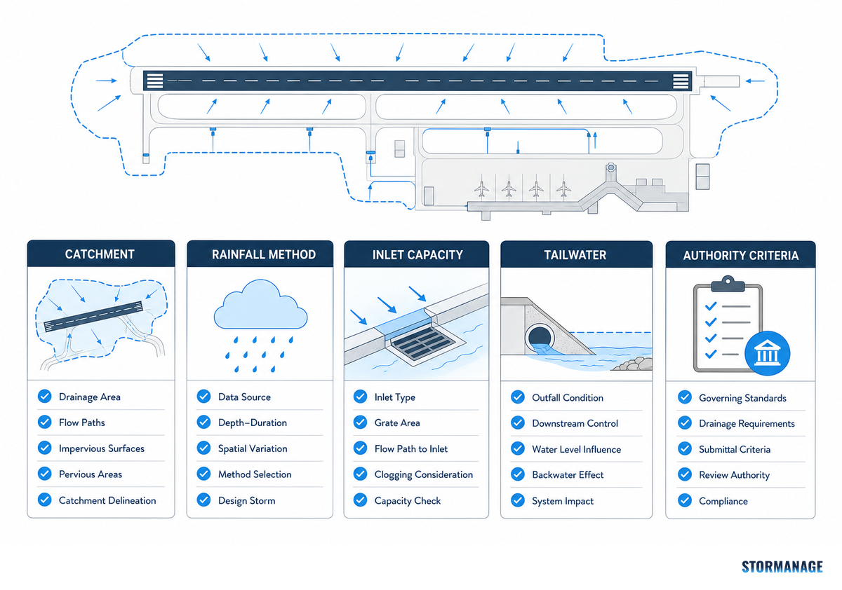
Runoff work has engineering value only after the team agrees on catchment limits, rainfall basis, surface response, flow route, downstream condition, and units. ACRP points airport users toward recognized hydrology methods, while EPA’s screening material stresses ranges of assumptions rather than one universal result. Use the calculation to expose decisions; don’t treat it as a stamped design.
When estimating runoff from heavy rainfall, distinguish a provisional peak from the large volumes of water that routing may spread over time. A high hydraulic loading signal or a surface runoff estimate is a prompt for an approved model, not a design answer by itself.
How do you estimate runoff for an airport drainage design?
Engineers can use a provisional Rational Method check where the governing engineer confirms it’s appropriate: Q = C × i × A. In customary units, Q is cubic feet per second when C is dimensionless, i is rainfall intensity in inches per hour, and A is area in acres. Its reliability depends on the locally approved rainfall event, mapped catchment, and chosen coefficient.
Worked hypothetical runoff example
Consider a planning team that maps a 3-acre paved apron catchment and, solely to check the arithmetic, assumes C = 0.90 and i = 2.0 in/hr. This gives Q = 0.90 × 2.0 × 3 = 5.4 cfs. If a separate, hypothetical downstream constraint is 2.0 cfs, the difference is 3.4 cfs. Over a 15-minute period, the provisional excess volume is 3.4 × 900 = 3,060 cubic feet, or about 22,900 gallons. This isn’t a universal detention target: a local design storm, timing distribution, routing model, tailwater, water-quality need, and authority review can change the result materially.
📐 Engineering Note
Keep a unit line beside every assumption. EPA describes its calculator as a screening tool for U.S. sites under 12 acres using long-term historical rainfall scenarios; an airport project may need a different method, event, or model.
4. Use Grades, Catch Basins, and Drainage Channels to Control Surface Water
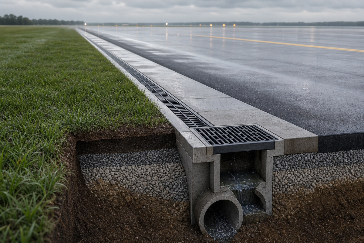
The FAA’s active airport drainage record places surface storm drainage for paved runways, taxiways, and aprons inside the circular’s scope. Within that boundary, surface collection begins with the slope and grade-to-low-point sequence, not an assumed spacing rule. Review the survey, then identify where water arrives, where it crosses pavement joints or edges, how catch basins and drainage channels receive it, and how a crew reaches the collection point after an event. Reviewed evidence doesn’t establish universal inlet spacing, grade, or inspection intervals, so those values belong to approved drawings and local criteria. Apply the same boundary to hydroplaning risk, runway flooding, and erosion of slopes: record the condition, then use the applicable airport criteria.
Can catch basins alone prevent runway ponding?
No. Catch basins collect at the low points created by the overall surface geometry; they can’t correct an unverified grade, obstructed approach path, damaged interface, or blocked downstream route. A practical walkdown follows the intended flow route in dry conditions, records sediment and debris paths, and checks whether access remains possible during an operating restriction.
Field review sequence
Confirm survey grades and predicted low points.
Follow the visible surface path to each collection point.
Record debris, sediment, pavement-edge, and access conditions.
Trace the route beyond the basin before judging the collection layout.
5. Keep Water Out of the Pavement Support System
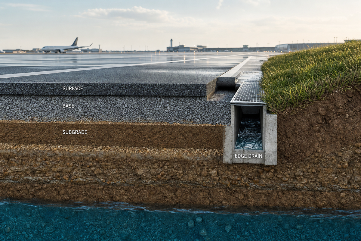
Surface water can appear controlled while subsurface water still reaches the pavement support system. The FAA drainage circular includes subsurface drainage for paved airside areas, which is a reminder to coordinate drainage drawings with geotechnical findings, pavement sections, observed groundwater, and the intended discharge route.
For subsurface drainage systems, use a short cross-section review: identify the surface entry point, the possible below-surface migration path, the intercept or subdrain concept, the outlet elevation, and the inspection evidence. Adequate subsurface drainage supports pavement durability by reducing the chance of a wet subgrade and weakened pavement foundations. Exact geometry and criteria remain project-specific; the guide can’t diagnose saturated and weakened pavement foundations or supply substitute values.
Airport runoff management needs integrated attention to quantity, chemistry, and toxicity.
6. Trace the Conveyance Route to Treatment, Storage, or a Controlled Outfall
Conveyance is a continuity check. Channels, underground pipes, ditches, shallow open channels, controls, and outfalls should form one traceable hydraulic route. ACRP treatment guidance notes that airport stormwater objectives can include peak-flow control, infiltration, temperature, attenuation, and removal of sediment, deicers, nutrients, bacteria, and metals. The objective must be named before a route can be judged. For a broader planning sequence beyond the airside boundary, the SuDS drainage development guide connects source, control, and downstream approval questions.
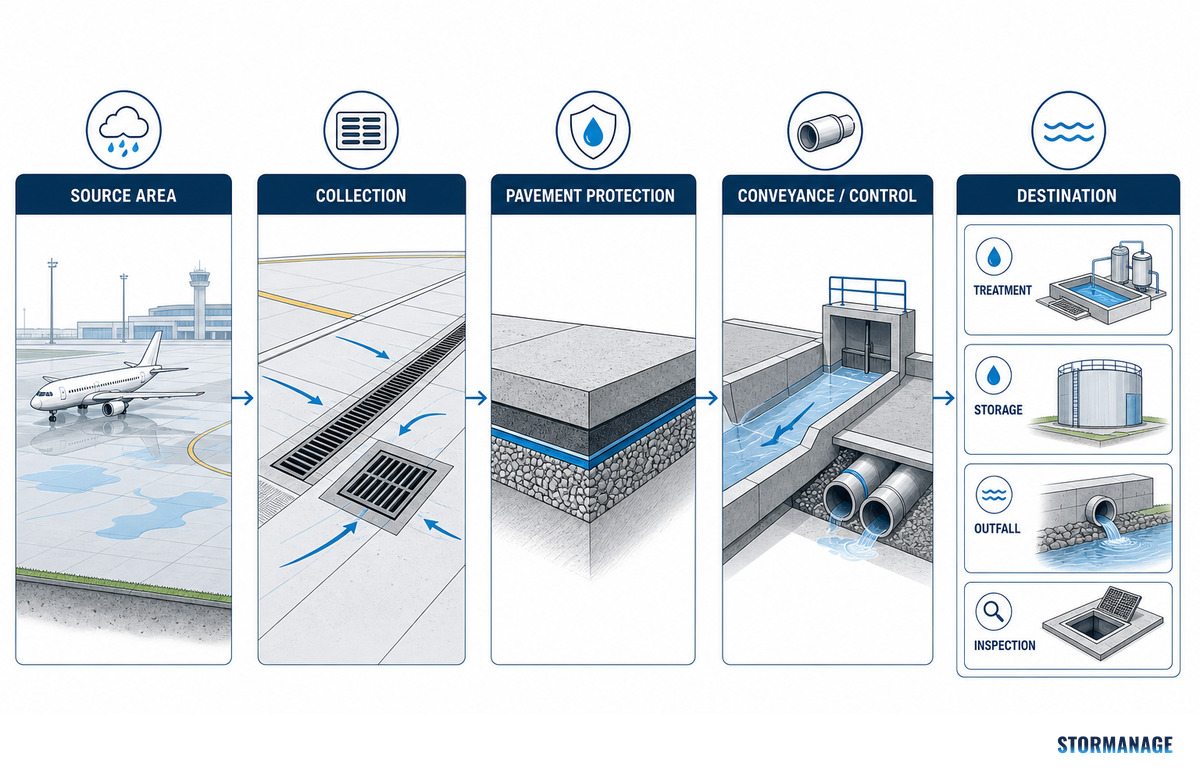
5-Step Airside Water-Path Decision Map
Definition: A five-step review that follows source area, collection point, pavement protection, conveyance/control, and the final storage, discharge, or inspection handoff.
Source: identify rainfall, wash, deicing, or other water at its origin.
Collection: confirm grade, low point, and access.
Protection: flag pavement support and erosion exposure.
Conveyance: trace every level change, control, and access point.
Destination: confirm treatment, storage, approved outfall, or an unresolved handoff.
Common mistake: “Treatment” has no single airport meaning. Peak-flow, sediment, and deicer objectives can require different control logic. Name the objective and responsible owner before calling the route complete.
7. Treat Aprons and Aviation Service Areas as High-Constraint Drainage Zones
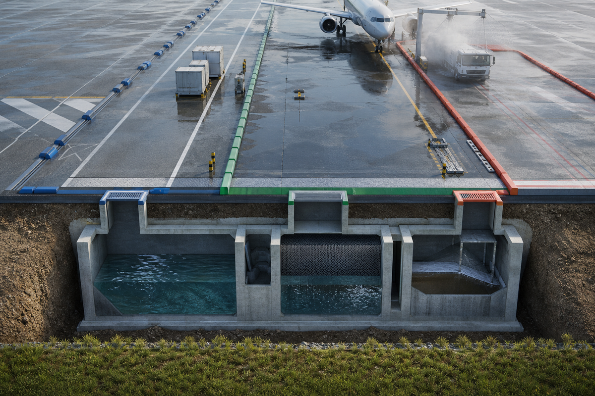
Apron drainage should begin by separating four pathways: ordinary stormwater, washwater, aircraft-deicing discharges, and pavement-deicing runoff. They may share geography, but they don’t automatically share a collection, treatment, isolation, or permit decision. In the United States, the federal 60% available aircraft-deicing-fluid collection requirement applies only to a defined subset of qualifying new cold-climate airport sources; existing-airport requirements remain permit-specific.
General aviation airports and larger hubs may de-ice aircraft or encounter aviation fuels under different operating and permit conditions. Whether a discharge is compliant is an environmental compliance decision for the applicable authority. Preserve those boundaries so stringent requirements aren’t copied from the wrong airport class.
Water pathway
First question
Do not assume
Stormwater
What surfaces and event flows enter?
That it has the same controls as service water
Washwater
What activity produced it?
That it is ordinary rainfall runoff
Aircraft-deicing discharge
Which jurisdiction and source class apply?
That the 60% rule applies universally
Pavement-deicing runoff
What material and destination are specified?
That it follows aircraft-deicing rules
April 2026 airport event
In April 2026, a Stormwater Solutions report described rapid snowmelt plus heavy rain overwhelming Delta County Airport drainage and closing runways. That report also recorded 2.21 inches of rain at O’Hare over six hours, with a ground stop and 62 cancellations. These are event facts, not a rainfall criterion or a failure-rate statistic. Their useful lesson is procedural: after a disruption, the airport team should preserve the rainfall record, affected low points, water type, access status, response timing, and downstream condition before deciding what changed in the system. Later review can compare those observations with the approved design basis, prior inspection records, and any temporary operating controls used during the event.
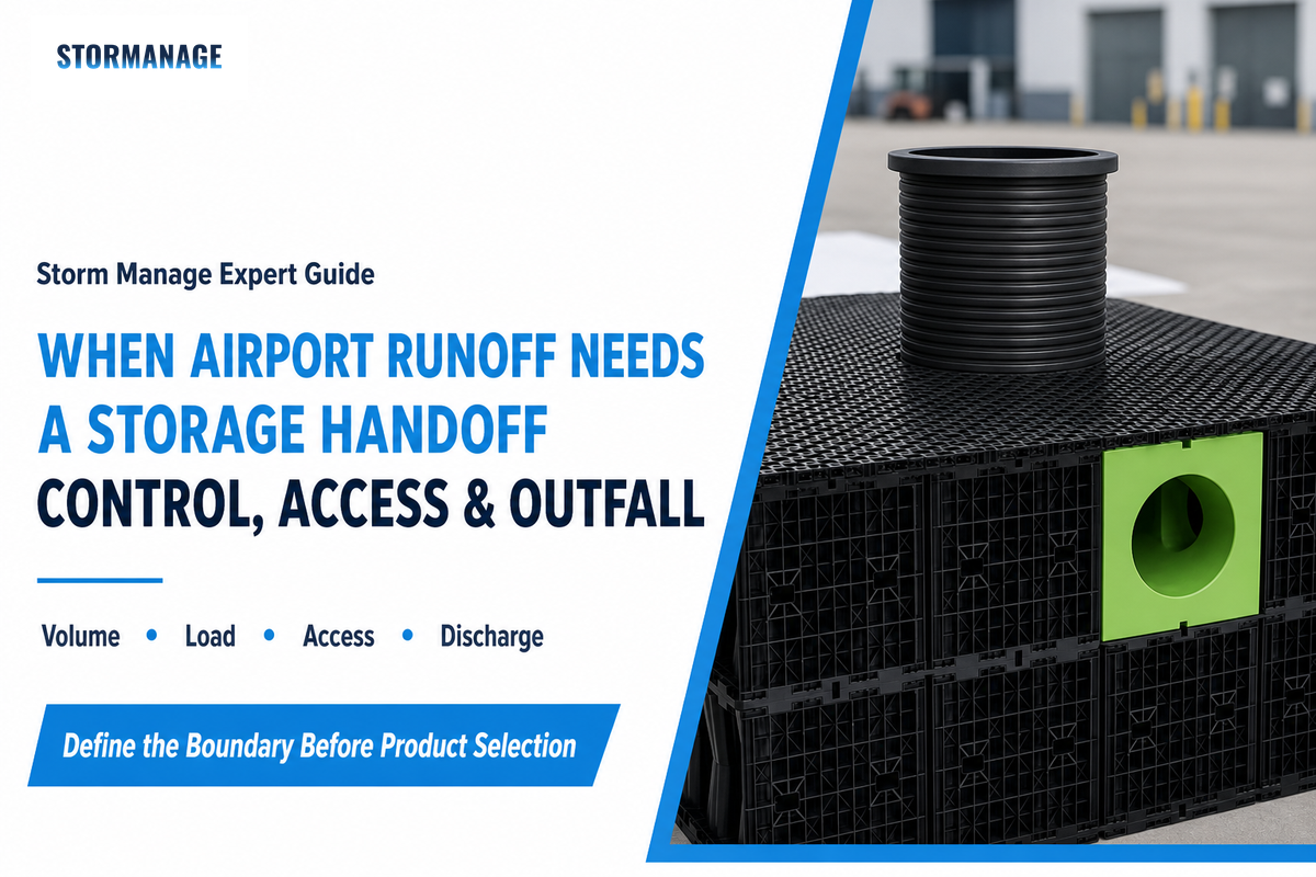
8. When Airport Rainwater Needs a Storage Design Handoff
Move to a separate storage review when the provisional water balance, constrained site, groundwater condition, downstream limit, or access requirement can’t be resolved in the drainage concept. ACRP’s stormwater and bird-hazard research shows why a bigger tank doesn’t neutralize an airfield wildlife hazard. Where applicable, treat the FAA 7460 process, Airport District Office, and wildlife-hazard coordination as separate siting gates rather than as a capacity calculation.
Owner decision scenario
An owner sees a provisional excess-flow figure and asks for more below-grade detention to avoid a revised outfall. Instead, the civil lead records three questions: whether the route has confirmed downstream consent, whether maintenance access remains safe during operations, and whether a detention or open-water concept changes bird-hazard exposure. Practitioners have reported both owner-required underground detention and cases where cost or practicality led elsewhere; that experience isn’t hydraulic proof. A defensible decision weighs cost-benefit, operating responsibility, and airport siting coordination alongside the hydrology. Continue the separate review through airport and industrial drainage application support.
9. Build Airport Stormwater Management Around Inspection Triggers
Airport stormwater management becomes visible when an inspection record connects a known low point to an owner and a response trigger. One regulated U.S. deicing-pad context includes a seasonal-start inspection, but that doesn’t create a universal interval. Set frequency through local procedures, seasonal exposure, past events, and asset condition. Preventing costly damage due to flooding while supporting safety and operational efficiency requires traceable evidence.
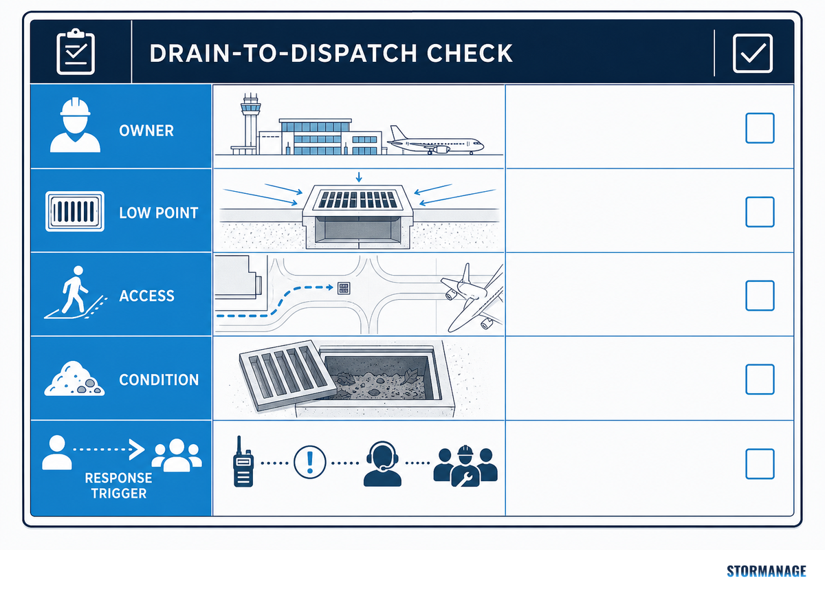
Drain-to-Dispatch Check
Definition: A field handoff record covering water-path owner, low-point evidence, access route, sediment or debris status, and the response trigger.
Use the check after:
ponding is observed near an operating surface;
sediment, vegetation, or debris changes the visible route;
erosion appears at a channel, ditch, or outfall;
an access route is blocked when a response crew needs it;
an event reveals a mismatch between the drawing and the field condition.
This named check is deliberately simple. It doesn’t set a universal schedule or declare an airside condition safe; it makes the evidence needed for the next decision easier to assemble.
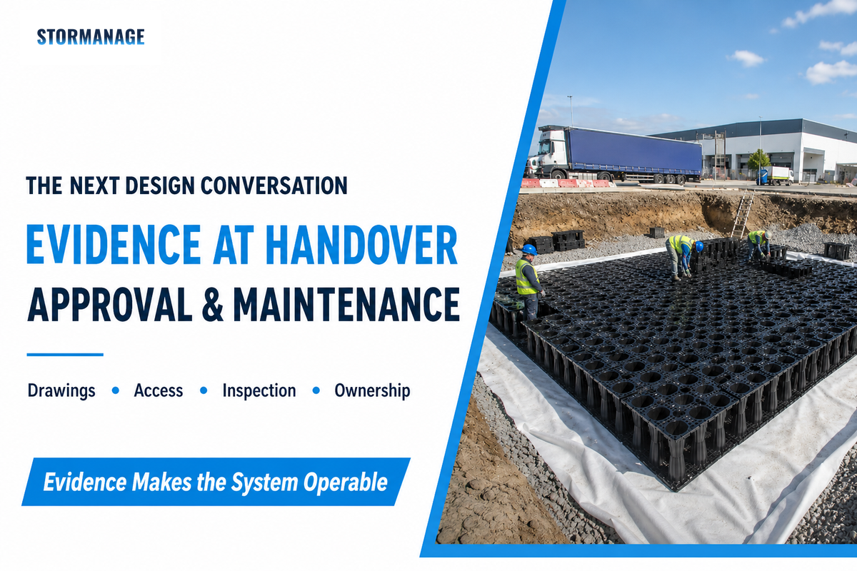
10. Outlook: Approval and Maintenance Evidence Will Drive the Next Design Conversation
For 2026, the strongest drainage decision is an evidence decision: teams that preserve dated assumptions, water-path ownership, inspection findings, and post-event records can explain why a concept remains suitable when rainfall scrutiny or operating conditions change. The FAA page for AC 150/5320-5D was updated in May 2026 and still lists the circular as active, but that status doesn’t replace local criteria or project approval.
A 2024 peer-reviewed airport-runoff review supports an integrated view of runoff quantity, chemistry, contaminants, toxicity, and remediation choices. For a team planning work in 2026, the action is practical: recheck live authority records, retain the calculation inputs and limits, and add FAA 7460, Airport District Office, and wildlife-hazard coordination to the approval route whenever storage siting could affect airport safety.
The practical risk is a concept that works hydraulically but can’t show current approvals, inspection ownership, or wildlife-siting coordination.
Search-demand background only: an adjacent commercial query rose year over year in the project keyword data. That directional signal isn’t an engineering forecast and shouldn’t replace hydrology, environmental, or airport-operating evidence.
FAQs: Airport Drainage System Questions
What happens if an airport drainage system fails in heavy rain?
View answer
A failure can appear as ponding, blocked access, erosion, water reaching pavement support, or a downstream condition the airport cannot accept. The immediate aviation decision belongs to airport operating procedures, not this guide. Preserve the event record: rainfall timing, affected zone, low-point condition, water type, debris or sediment, access status, and response actions. That record helps distinguish a local obstruction from a wider design, maintenance, or approval issue.
What is the frequency of inspections of the airport drainage system?
View answer
There is no single evidence-based interval for every airport drainage system. Set the calendar through airport procedures, seasonal conditions, known low points, service-area activity, past events, and asset condition. Add event-triggered checks after heavy rain, snowmelt, visible ponding, erosion, blocked access, or contamination concerns. The useful output is a dated record with an owner and escalation trigger, not an unsupported generic frequency.
Are aircraft able to use a runway that has water on the surface?
View answer
Operational authorization is determined by the airport, aviation authorities, aircraft operators, and applicable procedures. Surface water should trigger prompt observation and communication because its location, depth, movement, contamination, visibility, and pavement condition matter. A drainage guide cannot authorize runway use. Its role is to make the water path, low-point evidence, response ownership, and maintenance history available to those who hold the operational decision.
Are all airport drainage systems the same?
View answer
No. Climate, pavement layout, catchment, groundwater, downstream condition, service activities, environmental obligations, and airport procedures change the water path. A sound guide supplies questions and evidence requirements; the final arrangement remains site- and authority-specific.
What is the most demanding part of airport drainage maintenance?
View answer
The difficult part is often coordination, not a single visible task. A crew needs to know which low point matters, what water type is present, whether access is safe, where the route continues, and who can accept an escalation. Sediment, debris, erosion, vegetation, and pavement-edge changes can be easy to see but hard to interpret without the drawing and prior records. Aprons add another layer because washwater, aircraft-deicing discharges, and pavement-deicing runoff may require different handling. The Drain-to-Dispatch Check turns those observations into an owner, a condition record, and a response trigger. That is more useful than assuming every drain receives the same attention on the same date.
What is airport stormwater management?
View answer
Airport stormwater management is the planned control of rainfall runoff from airport areas so that collection, conveyance, water quality, discharge, pavement protection, and operations are considered together. It starts with source areas and ends with a documented destination or handoff. It should not automatically combine stormwater with washwater or deicing-related flows.
About This Analysis
This guide separates airport drainage system planning from commercial selection content. It uses reviewed public sources to explain runoff, airside water paths, and airport stormwater management questions, while recognizing that final design depends on local hydrology, geotechnical conditions, environmental obligations, airport procedures, and authority review. Reviewed by the Storm Manage technical team.